

Neighborhooods
Philadelphia,
the City of Neighborhoods
Rittenhouse Square
Rittenhouse Square is one of the five original open-space parks planned by William Penn and his surveyor Thomas Holme during the late 17th century. The tree-filled park is surrounded by high-rise residences, luxury apartments, an office tower, popular restaurants and shopping, as well as upscale hotels. Its green grasses and dozens of benches are popular lunchtime destinations for residents and workers in Philadelphia's Center City neighborhood.
Fitler Square
Fitler Square, between 23rd and 24th Streets and between Panama and Pine Streets, is in the southwestern part of Philadelphia's Center City district. Fitler Square was named for late 19th Century Philadelphia Mayor Edwin Henry Fitler. Today the neighborhood is mostly residential and composed of single-family homes, and it is within a short walk of the commercial areas of Center City.
Washington Square
Washington Square is an open-space park in Center City Philadelphia's Southeast quadrant and one of the five original planned squares laid out on the city grid by William Penn's surveyor, Thomas Holme. In 2005, the National Park Service took over ownership and management of Washington Square, through an easement from the City of Philadelphia. Washington Square is now part of Independence National Historical Park.
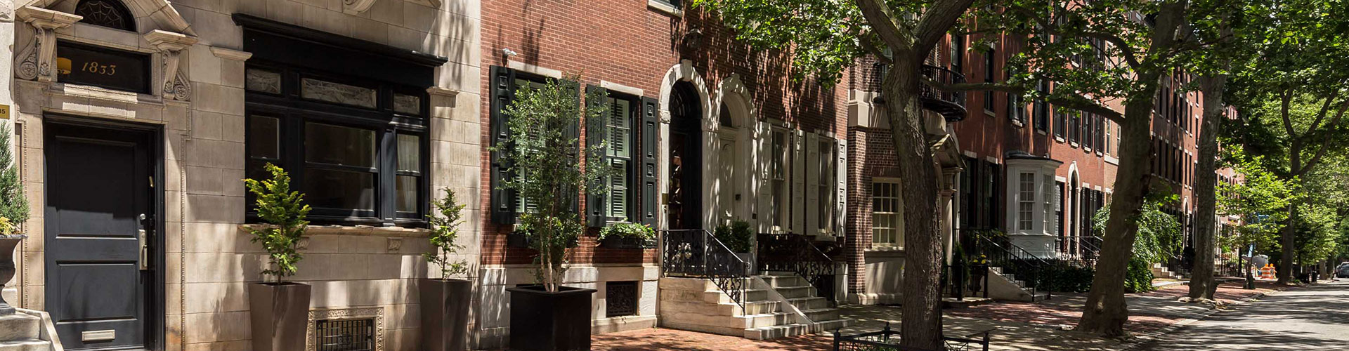
Society Hill
Society Hill is a neighborhood in Center City, loosely defined as bounded by Walnut, Lombard, Front and 7th Streets. It contains the largest concentration of original 18th- and early 19th-century architecture of any place in the United States. Society Hill is noted as a charming district with cobblestone streets bordered by brick townhouses in Federal and Georgian style.
Old City
Old City is a neighborhood in Center City where William Penn and the Quakers first settled. To tourists, it is best known as the site of Independence Hall and the Independence National Historic Park, as well as many of Philadelphia’s other historic sites. To locals, it is one of the city’s most popular nightlife destinations. The 3rd Street Corridor is home to many locally owned businesses, including galleries and boutiques.
Queen Village
Queen Village is a residential neighborhood that lies along the eastern edge of the city, immediately south of Center City. Historically, the area is part of old Southwark, Philadelphia's first suburb, which was incorporated into the city in 1856. Today, the South Street - Head House District is home to upwards of 300 cafes, restaurants, entertainment venues, and shops and to some 7,000 families whose median income and home values are among the highest in the city.
Graduate Hospital
Graduate Hospital, located in the Southwest Center City neighborhood, is named after the medical facility that is now Penn Medicine at Rittenhouse. Adjacent to Fitler Square and Rittenhouse Square, it is home to several community service organizations, many churches, a few retail establishments, some light industry and is home to primarily nineteenth and twentieth-century rowhomes.
Art Museum
The Art Museums District, also known as the Parkway Museums District or simply The Parkway, is in Center City along the Ben Franklin Parkway from Fairmount Hill to Logan Circle. The district gets its namesake from the museums in the area: the Philadelphia Museum of Art, Academy of Natural Sciences, the Rodin Museum, the Franklin Institute, the Barnes Foundation and the main branch of the Free Library of Philadelphia.